Environmental Monitoring Helicopter Services for Research Projects
KiliFlying Air provides specialized environmental monitoring helicopter services for research projects across Tanzania and East Africa, offering precise aerial platforms for wildlife population surveys, habitat change detection, vegetation health assessment, climate impact studies, and biodiversity inventories with minimal ecological disturbance and high-quality scientific data collection.
Environmental Monitoring Helicopter Services for Research Projects
Understanding environmental change requires consistent, accurate data over large and often inaccessible areas. Ground-based monitoring is limited by terrain, vegetation density, and logistical constraints, while satellite imagery lacks the resolution and timing flexibility needed for many ecological studies. Helicopters bridge this gap with controllable low-level flights that deliver high-resolution imagery and sensor data precisely when and where researchers need it. KiliFlying Air collaborates with universities, research institutions, conservation NGOs, and government agencies to support long-term environmental monitoring programs that inform policy, management, and scientific understanding.
Our environmental monitoring services emphasize scientific rigor – repeatable flight paths, calibrated sensors, and standardized protocols ensure data comparability across years and seasons. With deep experience in East Africa's ecosystems and commitment to minimal disturbance protocols, we enable researchers to collect robust datasets while protecting the very environments under study.
Wildlife Population Censuses & Distribution Studies
Accurate wildlife population estimates form the cornerstone of conservation management. Systematic helicopter surveys provide comprehensive coverage of large protected areas where ground counts are impractical, enabling researchers to assess elephant, giraffe, buffalo, and predator numbers across entire ecosystems.
Standardized transect methodologies with distance sampling produce statistically robust abundance estimates, while individual identification photography supports mark-recapture studies for species like lions and rhinos. Seasonal surveys track migration patterns, calving success, and mortality rates – critical indicators for ecosystem health monitoring in the Serengeti-Mara and Tsavo ecosystems.
Habitat Change Detection & Deforestation Monitoring
Land use change drives biodiversity loss across East Africa. Repeat helicopter surveys with high-resolution imagery enable precise change detection in forest cover, wetland extent, and rangeland degradation over time.
Annual or biannual flights document illegal logging in community forests, settlement encroachment into protected areas, or charcoal production impacts with evidentiary quality. Time-series analysis quantifies habitat fragmentation and corridor connectivity essential for species survival, supporting REDD+ initiatives and protected area management planning.
Vegetation Health & Ecosystem Function Assessment
Multispectral and hyperspectral sensors reveal vegetation health patterns invisible to the naked eye. Normalized Difference Vegetation Index (NDVI) mapping tracks seasonal productivity, drought stress, and invasive species spread across savanna and montane ecosystems.
Phenological studies monitor flowering and leaf-out timing as climate change indicators, while species composition mapping supports biodiversity hotspot identification. Thermal imaging detects water stress in key tree species or identifies hidden wetlands critical for wildlife during dry seasons.
Climate Change Impact Research
East Africa's sensitive ecosystems provide important signals of global climate change. Helicopter surveys monitor glacier retreat on Mount Kilimanjaro and Mount Kenya with high-precision photography and LiDAR for volume calculations.
Afro-alpine vegetation shifts are documented through repeat transects, while coastal surveys assess mangrove die-back and coral bleaching impacts. Long-term monitoring programs track tree line advancement, fire regime changes, and carbon stock variations essential for regional climate modeling and adaptation planning.
Biodiversity Inventory & Rare Species Monitoring
Remote areas harbor poorly documented biodiversity requiring targeted aerial search. Helicopters access isolated mountain blocks, forest canopies, and wetland complexes to locate rare plant communities or cryptic animal species.
Systematic grid surveys combined with expert observer teams produce comprehensive species inventories for new protected area proposals, while focused missions monitor known populations of endangered species like black rhinos or Grevy's zebras with individual recognition photography.
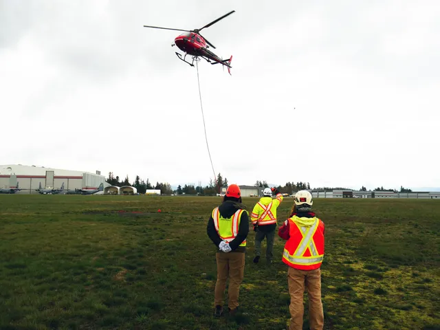
Technical Capabilities & Research Support
Our environmental monitoring helicopters support scientific requirements:
- High-resolution RGB and multispectral cameras
- Thermal imaging for heat signature detection
- LiDAR for canopy structure and topography
- GPS-guided transects with 1-meter precision
- Observer stations with data logging capability
- Quiet operation and high-altitude protocols
- Long-term repeatability for time-series studies
We assist with survey design, data management, and publication-quality reporting to maximize research impact.
Frequently Asked Questions
Environmental monitoring helicopter services from KiliFlying Air support critical research that protects East Africa's natural heritage. Advance scientific understanding with reliable aerial data collection. Explore our Aerial Survey and Helicopter Mapping for related capabilities.