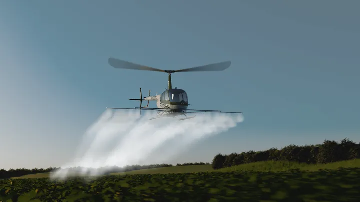
Crop Monitoring Helicopter Services for Large Fields
KiliFlying Air offers advanced crop monitoring helicopter services for large fields across Tanzania and East Africa, delivering timely aerial scouting and high-resolution imaging to detect pests, diseases, nutrient deficiencies, irrigation problems, and growth variability early – enabling precision interventions that optimize yields and reduce input costs on extensive commercial farms.
Crop Monitoring Helicopter Services for Large Fields
Managing thousands of hectares requires rapid, comprehensive visibility that ground scouting alone cannot provide efficiently. Early detection of crop stress factors – whether from pests, disease, nutrient imbalance, or water issues – allows targeted treatment that saves resources and protects yield potential. Helicopter monitoring combines speed, coverage, and detailed observation to deliver actionable intelligence across vast fields where variability can be significant due to soil differences, topography, or irrigation patterns. KiliFlying Air works with farm managers to design monitoring programs that integrate seamlessly with precision agriculture systems for data-driven decision making.
Our crop monitoring flights use experienced agricultural observers and advanced imaging technology to produce clear, georeferenced reports highlighting problem areas for immediate ground follow-up. Regular monitoring throughout the season establishes baseline health trends and enables proactive management that consistently improves farm profitability.
Early Pest & Disease Detection
Pests and diseases often start as small hotspots that spread rapidly without intervention. Low-level helicopter flights enable observers to spot characteristic symptoms – insect feeding patterns, fungal lesions, or viral yellowing – days or weeks before significant damage occurs.
High-resolution imagery captures subtle color changes while experienced scouts identify specific threats like fall armyworm in maize, coffee berry borer, or cassava mosaic virus. GPS-marked hotspots guide ground teams for confirmation and targeted spraying, minimizing broad-spectrum pesticide use.
Nutrient Deficiency & Fertilizer Optimization
Nutrient imbalances create visible patterns across fields that aerial viewing reveals comprehensively. Yellowing from nitrogen deficiency, purple tinges indicating phosphorus shortage, or interveinal chlorosis signaling micronutrient issues become clearly mapped from above.
Multispectral NDVI imaging quantifies vegetation vigor variations, producing prescription maps for variable-rate fertilizer application. Monitoring tracks response to applications, ensuring optimal nutrient use efficiency and preventing over-fertilization runoff.
Irrigation & Water Stress Management
Water management challenges are common in large irrigation schemes. Aerial surveys quickly identify wet spots, dry patches, or drainage issues across thousands of hectares, revealing sprinkler malfunctions, canal leaks, or soil compaction problems.
Thermal imaging detects temperature differences indicating plant water stress before visible wilting occurs. Regular monitoring supports irrigation scheduling adjustments and infrastructure maintenance planning for uniform crop development.
Weed Infestation & Growth Uniformity Assessment
Weed pressure varies significantly across fields and competes directly with crop resources. Aerial scouting maps weed patches for targeted herbicide application, reducing chemical volumes while controlling competition effectively.
Overall growth uniformity assessment identifies poor emergence areas, planting errors, or compaction zones requiring attention. Stand counts from imagery support replanting decisions and yield forecasting accuracy.
Yield Estimation & Harvest Planning
Pre-harvest aerial surveys provide reliable yield estimates through pod/ear/head counting and biomass assessment. Consistent monitoring throughout maturity stages tracks grain fill progress and identifies areas at risk from lodging or disease.
Detailed field maps support harvest logistics planning – routing combines efficiently, scheduling labor, and preparing storage based on expected volume distribution across the farm.
Technical Capabilities & Monitoring Tools
Our crop monitoring helicopters deliver comprehensive data:
- High-resolution RGB imaging (sub-centimeter detail)
- Multispectral cameras for NDVI and health indices
- Experienced agricultural observers
- GPS-tagged hotspot reporting
- Georeferenced orthomosaics and zone maps
- Weekly/bi-weekly flight scheduling
- Integration with farm management software
Reports include annotated imagery, priority action lists, and trend analysis for season-long insights.
Frequently Asked Questions
Crop monitoring helicopter services from KiliFlying Air provide early warning and precision insights for large field management. Protect your investment with professional aerial scouting. Explore our Agricultural Services for complementary spraying capabilities.